


Urban planning is a complex field that requires a careful equilibrium between infrastructure growth, environmental factors, and community requirements. Over time, planners have depended heavily on conventional methods like ground surveys, satellite images, and historical records to guide their decisions. However, these methods, despite being relatively productive, suffer from outdated data, high costs, and cumbersome procedures.
Recently, drone mapping software has become a crucial solution to these obstacles. This innovation changed the scenario of urban region observation and development. Offering precision with data in real-time, allows the planners to conduct the tasks with a sense of resolution that was unknown previously. The potential to revolutionize the practice of urban planning is vast by incorporating innovation to practicality through this methodology, as the city shall expand in sustainable and productive ways.
Urban planning in the past greatly relied upon satellite images, ground surveys, and historical data to come up with development plans. Although these approaches have their benefits, they can be laborious, costly, and sometimes rely on outdated information. Drone mapping addresses these issues in urban planning by offering:
By providing accurate perspectives, drone mapping software supports informed decisions, making it a valuable tool for city planners aiming for accuracy and productivity.
The integration of drone mapping software into urban planning workflows offers several advantages:
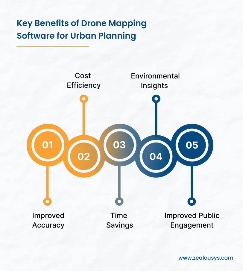
Drone mapping software provides centimeter-level accuracy, ensuring that planners have the most precise data possible. This is very important, especially for zoning, infrastructure design, and land-use planning.
In the majority of traditional survey approaches, much manpower and several pieces of equipment are needed. Drones easily undertake this process and make it cheaper, resulting in better results at a lower cost.
Processes that once took weeks or months now take only a few days. It speeds up data collection and processing, allowing planners to focus on making decisions.
Thermal or multispectral camera-enabled drones can capture data on the environment, like the health of vegetation or water distribution. This aids planners in injecting as much sustainability as possible into their designs.
The high-quality visuals generated by drones can be used to effectively convey plans to the public. The more captivating these images are, the better stakeholders will be able to comprehend and accept proposed developments.

Drone mapping software is versatile and can be applied across various facets of urban planning. Below are some of its primary applications:
Drones provide a bird’s-eye view of existing land use patterns, helping planners identify suitable zones for residential, commercial, and industrial developments.
Drones are very instrumental in designing transport systems and investigating the state of infrastructure in place; in turn, these give valuable insights that can steer effective infrastructure planning.
Drones could fly over post-disaster sites to give an immediate survey of the area, significantly enhancing the efficiency of recovery operations.
Drone mapping allows planners to track alterations in urban areas over time, ensuring that development progresses in line with long-term goals.
Drones help identify underutilized areas that could be converted into parks or recreational areas, a move that enhances urban livability.
Urban planning typically involves various stakeholders, including government bodies, architects, engineers, and community representatives. Drone mapping software promotes collaboration by:
By improving collaboration, drone mapping software not only speeds up project timelines but also improves the quality of urban development efforts.
Despite its numerous advantages, the implementation of drone mapping software in urban planning presents some challenges:
Drone operations are subject to strict regulations regarding airspace, privacy, and safety, making compliance complex and time-consuming.
Although drones and mapping software can yield long-term savings, the initial setup costs may pose a challenge for smaller municipalities or companies.
The immense volume of data produced by drones necessitates strong storage and processing capabilities, which can demand considerable resources.
Using drone mapping software effectively requires specialized skills, including drone operation and geospatial data analysis, which adds to training costs for personnel.
The drone operations heavily depend on weather conditions; thus, this might limit their usage when weather conditions are not favorable, such as in polar or desert climates.
Drone mapping software is transforming urban planning by improving how cities are designed and managed. A drone software development company provides real-time data and improves collaboration, allowing planners to create smarter and more sustainable urban environments. Overcoming challenges like regulations and high initial equipment costs will help unlock the full potential of this technology.
As urban areas continue to grow, the significance of innovative technologies like drone mapping will become even more essential. With these advancements, urban planners can guarantee cities that are livable, efficient, and resilient for future generations.
Our team is always eager to know what you are looking for. Drop them a Hi!

Pranjal Mehta is the Managing Director of Zealous System, a leading software solutions provider. Having 10+ years of experience and clientele across the globe, he is always curious to stay ahead in the market by inculcating latest technologies and trends in Zealous.
Comments